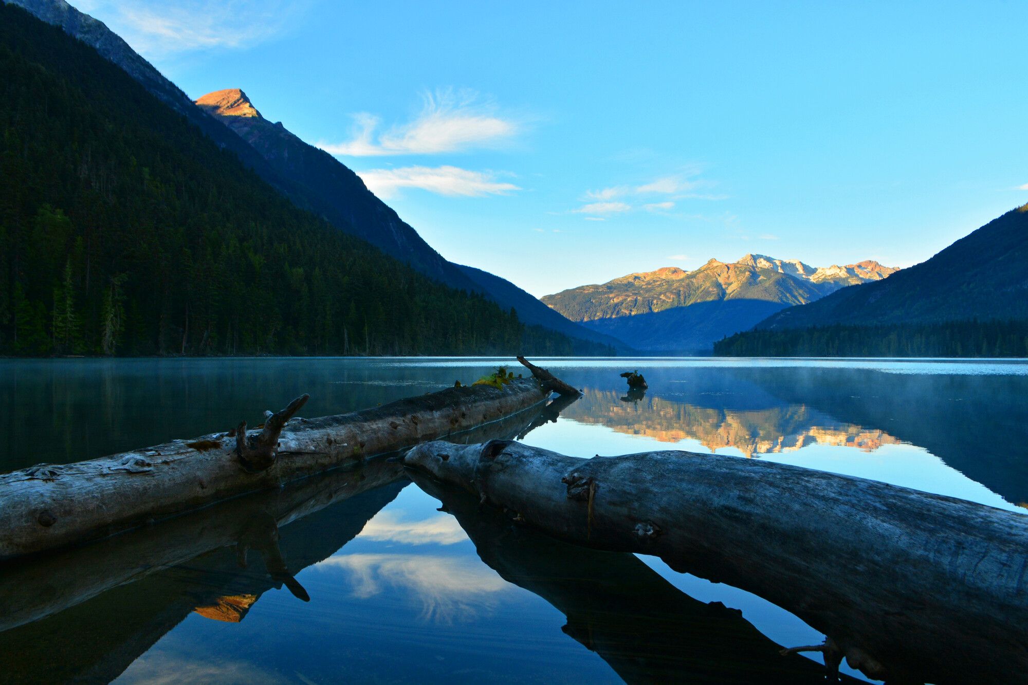
Park overview
Birkenhead Lake Park was first established in 1963 to provide lakeside camping and other recreation experiences for travellers between Whistler and Lillooet. The park was expanded in 1996 from 3,642 hectares to 9,755 hectares, adding significant conservation values of the Sockeye Creek watershed. The park was again expanded by 684 hectares in 2008 to include more of the alpine headwaters of the western side of the Sockeye Creek watershed.
The park protects important habitat for a variety of wildlife, including spotted owls, mountain goats, black bears, and grizzly bears. Old growth forests, subalpine and alpine environments, large and small lakes all contribute to the park’s diversity.
Advisories
Dates of operation
The park is open May 15, 2024 to September 30, 2024
- Facility type
- Frontcountry camping
- Number of campsites
- Reservable frontcountry sites: 78
- Vehicle-accessible sites: 78
- Main operating season
- 2024: May 15 to September 30
- Winter season
- Not known
- Booking required
- 2024: May 15 to September 29
- Facility type
- Frontcountry camping
- Number of campsites
- Vehicle-accessible sites: 13
- Main operating season
- 2024: May 15 to September 30
- Winter season
- 2024: October 1 to May 14
- Service note
- Throughout the year until snowfall. The main park road is not plowed during winter.
- Booking note
- First come, first served, only.
- Winter season note
- High density campground remains accessible in the fall after the main campground closes but may not offer full services such as water, regular garbage collection, security and firewood sales. Please bring your own firewood and do not collect firewood from within the park. Be "bear aware." A reminder: there is no cellular phone coverage in the park.
Safety info
- Bears are very active in this park. Please read the bear safety information.
Special notes
- Entrance gates are closed 10pm to 7am
- Quiet hours are 10pm to 7am. Music, generators, etc. must be shut off completely between these hours.
- Generator use is only permitted between the hours of 9am and 11am, and from 6pm to 8pm. View the generator policy
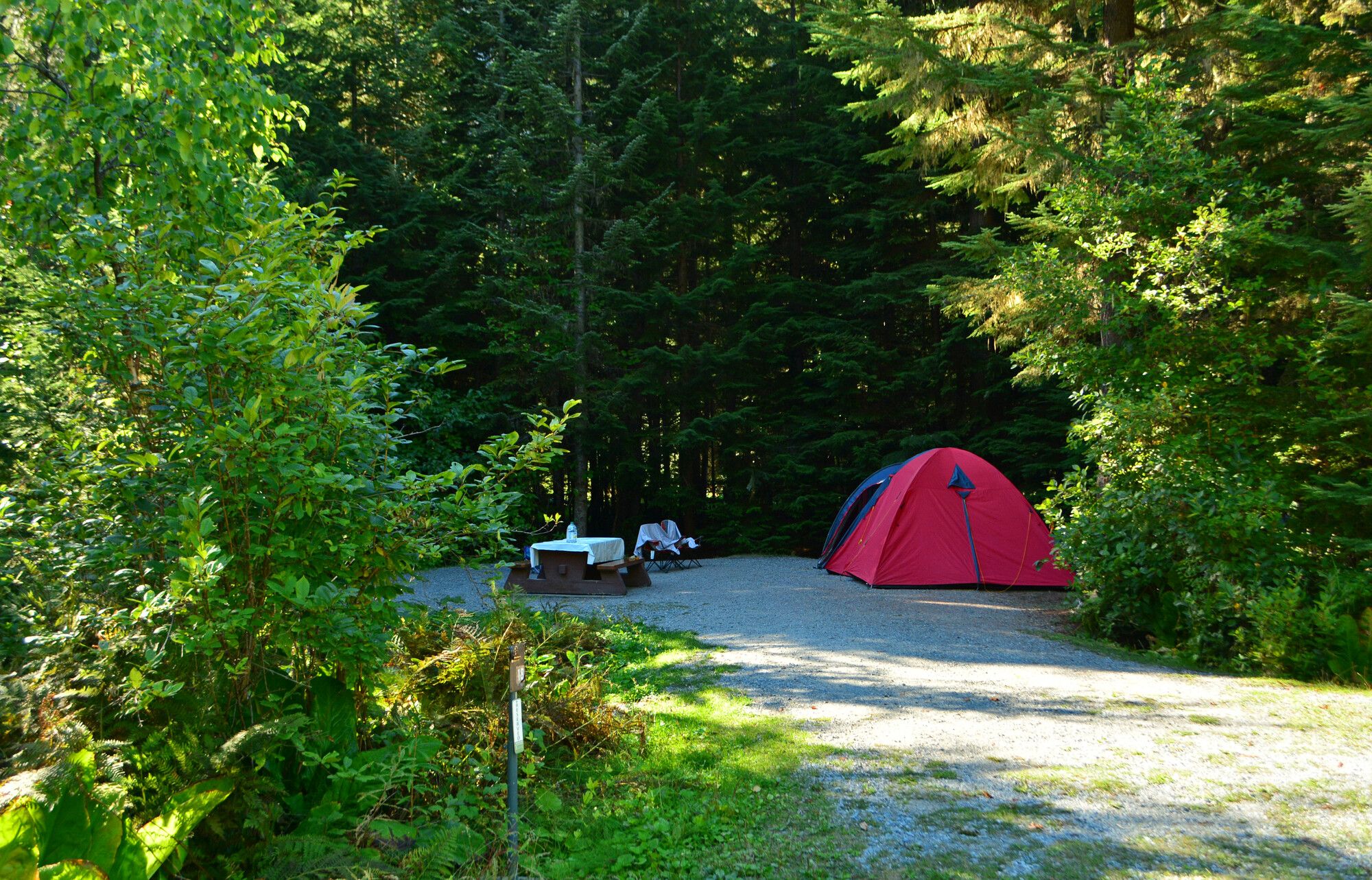
Camping
- Total number of campsites
- Total reservable frontcountry sites: 78
- Total vehicle-accessible sites: 91
Camping reservations are available through the BC Parks reservations system. When reservations are not available, all campsites function as first come, first served. Cash only accepted on site.
This park offers vehicle accessible campsites, seven of which are double sites. Campsite reservations are accepted and first come, first served sites are also available.
- There are no pull through sites. There is room for a maximum of two vehicles per site (extra vehicle fee applies).
- No extra parking is available.
- There is no gatehouse. There is a locked gate in the off season, generally from late October to early May, however you may still hike in and camp.
- There are no facilities or services available, and no fees, in the off-season.
- A sani-station is available and operational only during the full service camping season.
- Cash only accepted at this park.
If there is no staff available to direct you to a site, check the reservation board at the park entrance, then choose a site with no reservation or camping receipt posted at the campsite. Staff will come around to collect fees. The closest store is D’Arcy approximately 22 kilometres on the Pemberton Portage Road. The nearest pay phone is also in D’Arcy.
| Vehicle-accessible camping fee | $22 per party per night |
| BC seniors’ rate (day after Labour Day to June 14 only) | $11 per senior party per night |
For information on the BC seniors’ rate, see the camping fees page.
Facilities
Accessibility information is available for this park.
A pressurized, treated water system is now available. Potable water is available at taps in the main campground, the high density campground and the sani-station.
During the collecting season a sani-station is available and a fee is charged for the service. Cash only.
While campfires are allowed and campfire rings are provided at each campsite, we encourage visitors to conserve wood and protect the environment by minimizing the use of fire and using campstoves instead.
Firewood can be purchased in the park (cash only) or you may bring your own wood. Fees for firewood are set locally and may vary from park to park.
To preserve vegetation and ground cover, please do not gather firewood from the area around your campsite or elsewhere in the park (this is a ticketable offence under the Park Act). Dead wood is an important habitat element for many plants and animals and it adds organic matter to the soil.
Campfire bans may be in place. Before lighting a fire, check for bans or restrictions on BC Wildfire Service and on local or Indigenous government websites.
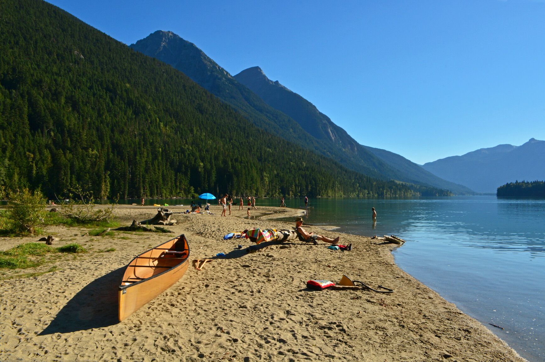
There is a day-use and picnicking area with picnic tables and parking area. Some of the picnic tables have barbeque attachments, bring your own briquettes. There are no fire pits in the day-use area and open fires are not permitted. There is a sandy beach. There are no phones in the park. A pay telephone is located at D’Arcy, 22 km (13 miles) away on Portage Road.
Activities
For your own safety and the preservation of the park, obey posted signs and keep to designated trails. Shortcutting trails destroys plant life and soil structure.
Caution: The lakeside Wilderness trail and the Birkenhead Lake trail: approximately 1km from the trail head at the parking lot, both of these trails cross a 50 metre section of a rock debris avalanche path. Trail users must use caution when crossing over loose rock rubble and may be required to ford the stream. Crossings should be avoided during periods of prolonged, heavy rain.
Wilderness trail
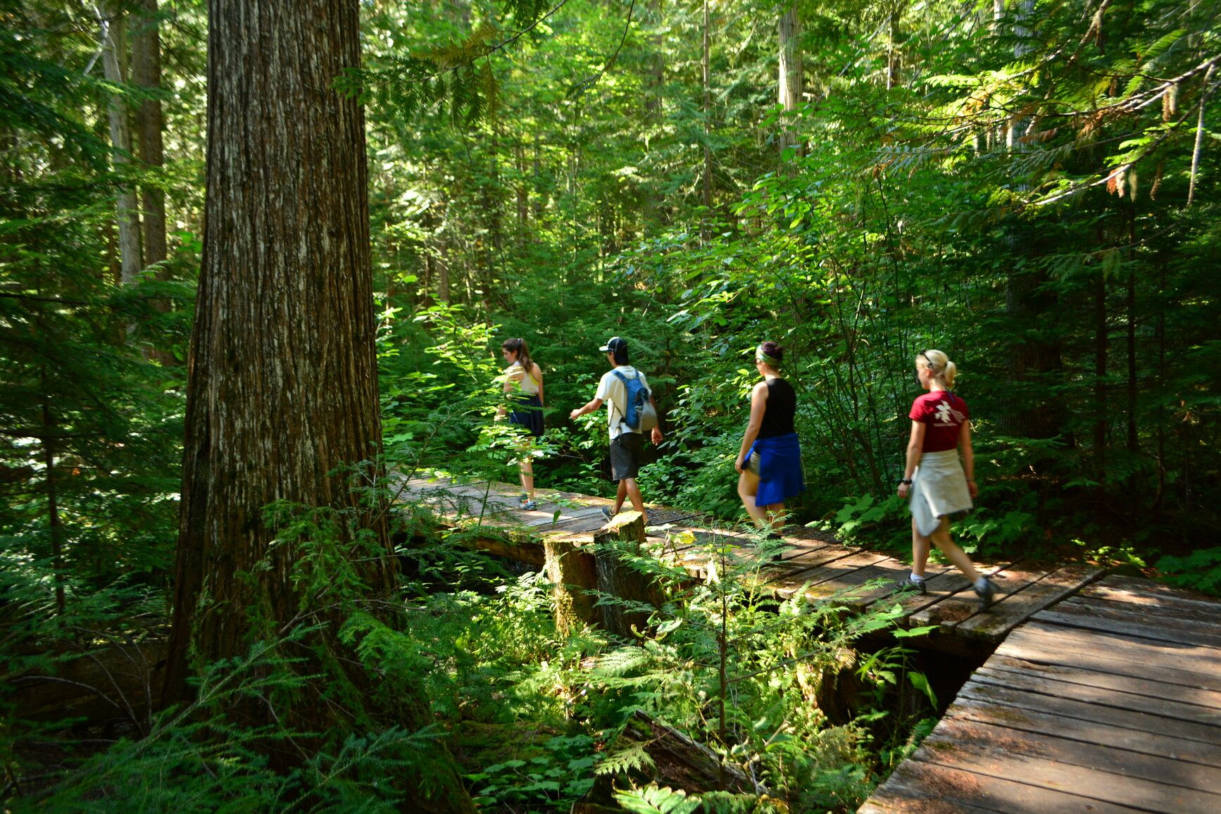
A 2km hiking trail through old growth forest leads to a flat, treed area with views of the mountains across the lake and views back of the day use area beaches. A short section connects with the Birkenhead Lake Trail, allowing for a longer hike or a loop back to the trailhead.
Birkenhead Lake trail
The 8km trail to Birkenhead Lake Estates at the south end of the lake joins up with Birkenhead Road and Tenas Valley logging road. This trail is used by both hikers and cyclists. There may also be horseback riding on the west half of the Birkenhead Lake trail up to Sockeye Creek. Motorized vehicles are not permitted on this trail.
Goat Lookout trail
This 1km trail on the south side of the valley is a bit rough and steep in places, but offers a view of the lake at the end and in the spring and fall mountain goats may be seen on the cliffs above the campground.
Caution: During the spring snow melt (April to June), Phelix Creek water levels rise and may crest the log bridge approximately 100 metres from the start of the trail. High water conditions may require temporary seasonal closure of the trail. Best you otherwise hike the trail in the mornings during May and June.
There is a sandy beach and swimming is available in this cold water lake. August is usually the warmest water month. Stay within the swimming area identified by the marker buoys. There are currently no swimming floats.
There are no lifeguards on duty in BC Parks.
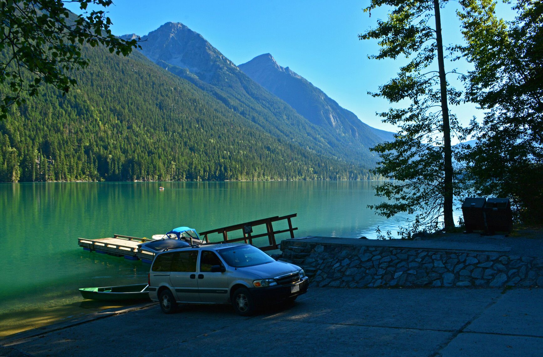
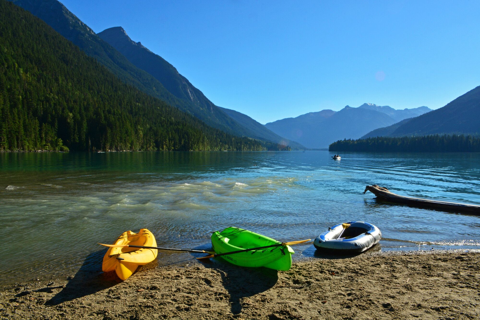
Canoes and kayaks are welcome but be aware of strong winds which can blow up suddenly on the lake. There are no developed, boat accessible campsites on the lake. Daily and hourly canoe rentals are available on site. For more details, please contact the park operator.
Good fishing for Kokanee and Rainbow Trout. There are no Dolly Varden in Birkenhead Lake.
Fishing regulations require anglers to release all Bull Trout caught. Bull Trout are on the endangered species list. Some anglers have mistaken the Bull Trout species for a Dolly Varden. Since the Bull Trout species has suffered, there is currently a recovery program in place and the park is requesting the public’s assistance.
Anyone fishing in British Columbia must have an appropriate licence. To learn more, see the fishing and hunting guide.
The Freshwater Fisheries Society of BC has a fun, hands on, Learn to Fish Program that teaches basic angling skills to youth under 16 years old. Check back to this page or ask the park operator for information.
Pets and domestic animals must be on a leash at all times and are not allowed in beach areas or park buildings. However, there is one designated open area at the far end of the day-use area for dogs. You are responsible for their behaviour and must dispose of their excrement. Backcountry areas are not suitable for dogs or other pets due to wildlife issues and the potential for problems with bears.
Bicycles must keep to roadways and designated mountain bike trails.
Birkenhead Lake Trail
The 8 km gravel trail to Birkenhead Lake estates at the south end of the lake joins up with Birkenhead Road and Tenas Valley logging road. This trail is used by both hikers and cyclists.
Caution: There may also be horseback riding on the west half of the Birkenhead Lake trail up to Sockeye Creek.
During the winter season, the 2 km road from the park gate to the lake is good for cross-country skiing and snowshoeing.
Located 22 km West of D’Arcy, 90 km North of Whistler, 145 km North of Squamish. Take Highway 99 from Pemberton northeast to Mt. Currie, turn off Highway 99 to D’Arcy. Just before D’Arcy (about 50 km from Mt. Currie) there are highway signs indicating a turn off on to a gravel road that leads to Birkenhead Lake. From there it is a 17 km drive along a gravel road. The nearest communities are D’arcy, Pemberton, and Mt Currie.
Park and activity maps
Any maps listed are for information only; they may not represent legal boundaries and should not be used for navigation.
Learn more about this park
Park details
- Date established: October 10, 1963
- Size: 10,439 hectares
Park contact
Sea to Sky Park Services Ltd.
604-986-9371
info@seatoskyparks.com
seatoskyparks.com
Nature and culture
History
Established in 1963. Named after the troopship “Birkenhead” which sank off the Cape of Good Hope after striking a rock.
Conservation
Birkenhead Lake Park’s geographic location affects its climate. It lies in the transition zone between the wet coast and the dry interior. These conditions provide a diverse range of plants and animal species here.
Moisture-laden air coming from the coast is pushed higher and higher into the Coast Mountains. Cooling as it rises, the moisture in the air becomes rain, or snow in the winter.
When the air passes over the crest of the Coast Mountains, it warms up. Having lost most of its moisture on the coastal side of the mountains, it is much drier as it descends into the interior valleys. The average rainfall in communities near Birkenhead Lake demonstrates this phenomenon. Pemberton, on the wet side, gets an average of 92cm, whereas Lillooet, just a bit further inland, gets an average of 29cm of precipitation per year.
One of the mandates of BC Parks is to preserve representative areas of different forest types. A walk along the trail to the wilderness campsite on the northwest side of the lake will take you through some wonderful old-growth forest. Here there is a mix of tree species: Douglas-fir, western hemlock, western red cedar, cottonwood, and Engelmann spruce.
A mixed stand with a wide range of age classes, from seedlings, old giants, to dead and dying trees, provides the best habitat for many species of plants and animals.
When a large tree falls in the forest, it not only provides habitat and food for many animals, it also allows more light to reach the forest floor. Young trees and a wide range of other plants will grow in the new opening. Flowers, trees, and shrubs are part of the park's natural heritage, please don't damage or remove them.
Wildlife
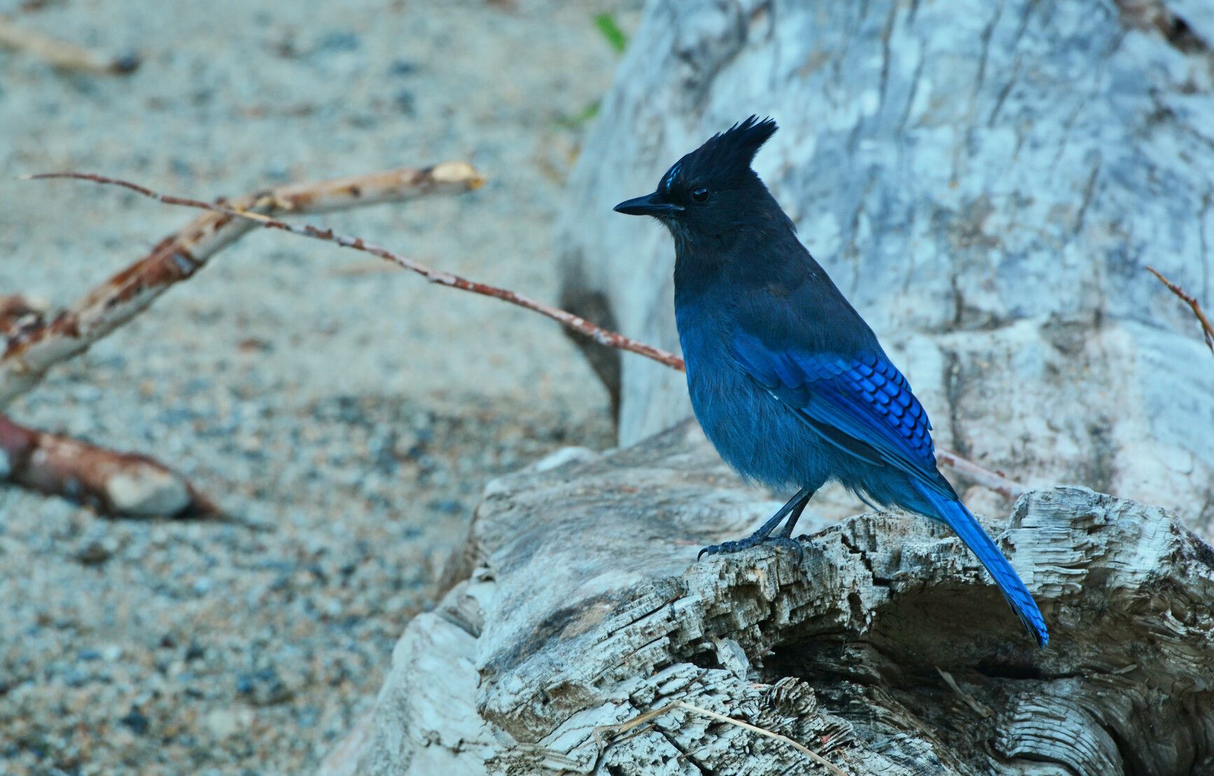
Watch for moose, blue herons, grouse, snowshoe hare, osprey, deer, and mountain goats. Park users should always be aware of bears and other wildlife in our park environment. Never feed or approach bears or other wildlife.
Reconciliation with Indigenous Peoples
BC Parks honours Indigenous Peoples’ connection to the land and respects the importance of their diverse teachings, traditions, and practices within these territories. This park webpage may not adequately represent the full history of this park and the connection of Indigenous Peoples to this land. We are working in partnership with Indigenous Peoples to update our websites so that they better reflect the history and cultures of these special places.